Chesapeake Conservancy Featured as “Thought Leader” at Esri International User Conference
 Annapolis, MD – This week, the Chesapeake Conservancy was awarded Esri’s first-ever See, Find, Share award at the company’s International User Conference in San Diego, California. See, Find, Share is the Chesapeake Conservancy’s second international award from Esri. It spotlights years of work at the Conservancy’s Conservation Innovation Center to become a trailblazer in cutting-edge conservation technology.
Esri is the world’s foremost mapping software company with millions of users across government agencies, Fortune 500 companies, local businesses, and non-profit organizations. Their products are essential for conservationists to make strategic decisions about where and how to do their work.
“This is a significant achievement for the Chesapeake Conservancy. Our staff are conservation entrepreneurs who are changing the American conservation movement through landmark conservation initiatives, and we are grateful for this wonderful recognition,” Chesapeake Conservancy President and CEO Joel Dunn said.
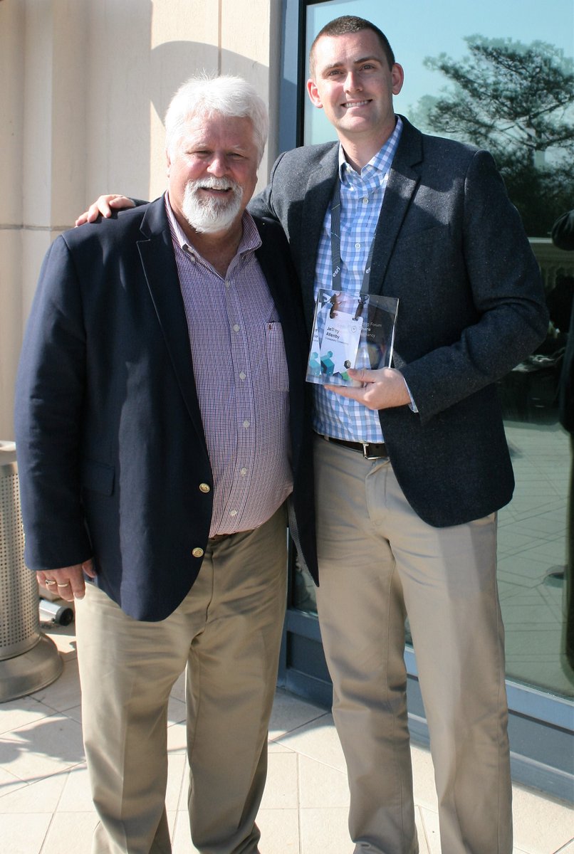
“We are honored to be able to work with Esri and push the limits of how technology can help inform conservation and restoration, both in the Chesapeake and around the globe,” Chesapeake Conservancy Director of Conservation Technology Jeffrey Allenby said.
At the conference, Allenby also was featured as a “thought leader” for his piloting of the Conservancy’s innovative work in applying mapping technology and enabling under-resourced partners to meet conservation goals. He had several speaking engagements, including a keynote presentation entitled “Conservation Innovation: Leveraging Technology to Identify Landscape Scale Conservation and Restoration Priorities.”
Chesapeake Conservancy Solutions Engineer Colin Stief and Geospatial Project Manager Cassandra Pallai also presented at the conference.
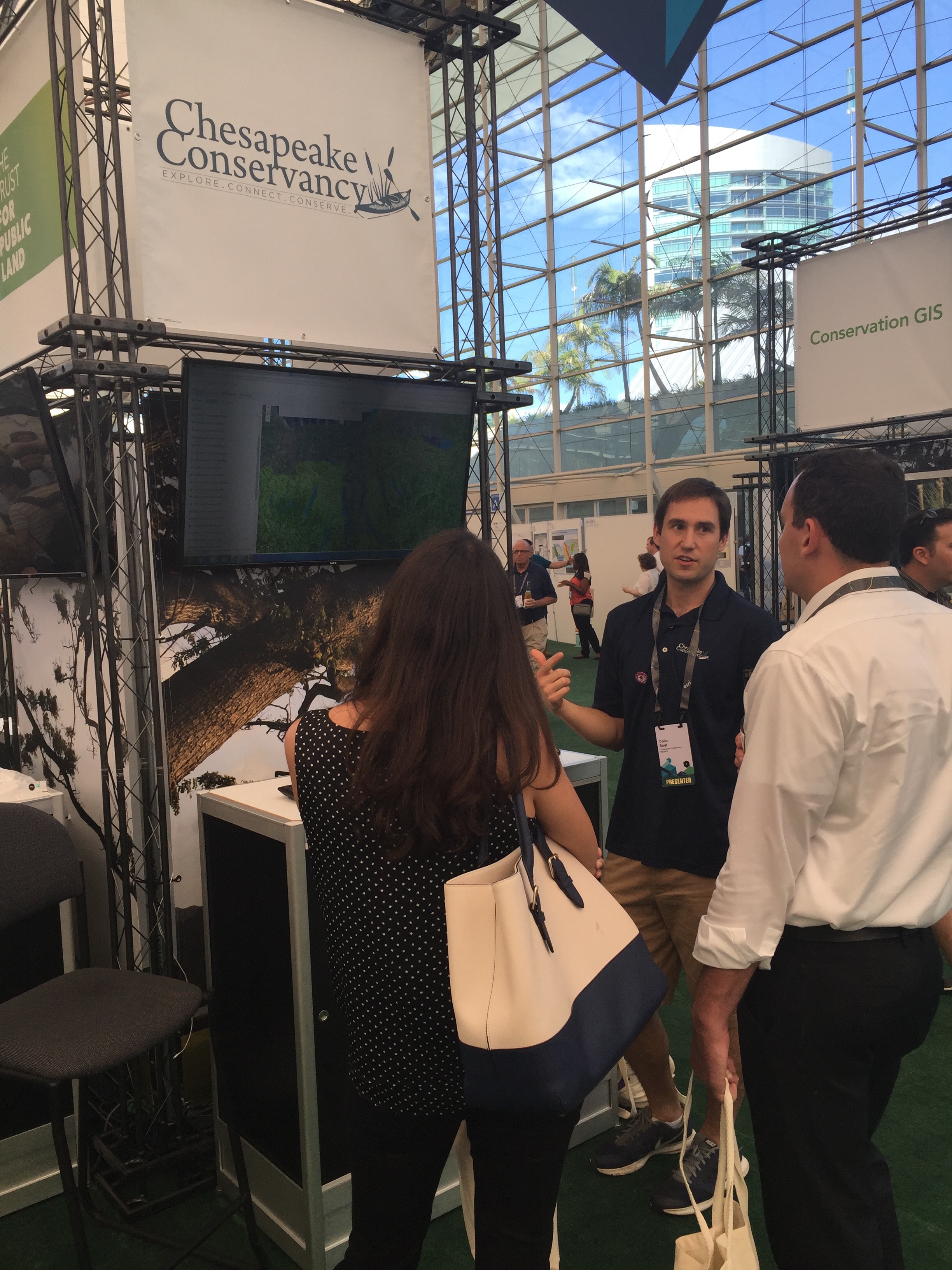 A core of the Conservancy’s technology program involves collaborating with local partners to identify and address their biggest technology challenges using data and customized web-based applications. Stief’s presentation about those efforts was entitled, “Geospatial Decision-Making for the Non-GIS User.” He explained that organizations want to apply mapping technology in their work, but lack the resources and capacity to do so. To help these organizations, the Chesapeake Conservancy has developed the “Conservation Toolbox,” a web application for characterizing properties and assessing how well they meet certain conservation and restoration criteria. Users can view ecological and cultural data, perform simple landscape analyses, and most importantly, export their work as clear and concise reports.
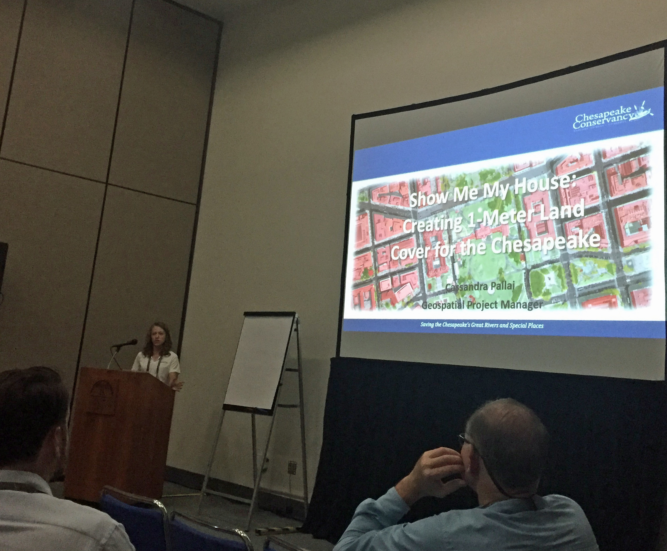 Pallai delivered two different presentations. The first was entitled, “Show me my house: Creating 1-meter land cover data for the Chesapeake.” In that session, she detailed the Conservancy’s creation of a groundbreaking Chesapeake Bay-wide dataset that characterizes the entire watershed’s landscape in very high resolution. This product will give partner organizations the power to make effective and impactful decisions about where to target their efforts. The second presentation was about an application of the data: “Prioritizing Riparian Gaps for Restoration.” Her talk focused on new Conservancy projects to help partners identify places where the Chesapeake’s rivers and streams are unprotected, and to pinpoint which of those unprotected spots are most important for water quality.
Last year the Chesapeake Conservancy was honored with a Special Achievement in GIS Award at the 2015 Esri International User Conference.