Nanticoke River Conservation Opportunities Analyst
The Nanticoke River Conservation Opportunities Analyst is the result of a study sponsored by The Lincoln Institute of Land Policy and performed by Chesapeake Conservancy. The objective of the project is to provide an on-demand prioritization tool that balances multiple conservation needs throughout the Nanticoke River corridor. A number of conservation organizations and federal agencies operate in this area with a variety of goals. Some are interested in the historical resources of the region, some on creating public access, some on minimizing the impact of military operations, and some on protecting wildlife habitats. While each objective is important, to create a region-wide conservation planning effort, a tool such as this one is needed to balance each interest and identify areas that can provide a multitude of benefits.
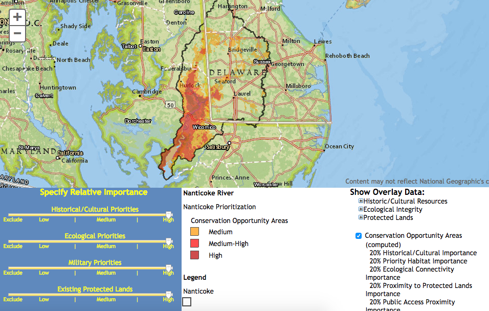
This tool is meant to provide an overview of the resources and priorities along the Nanticoke River to help policy makers and the public identify opportunity areas for conservation investment. The tool incorporates:
- Historical and Cultural Resources
- Ecological Resources
- Military Use Areas
- Proximity to Existing Protected Lands
- Proximity to Existing Public Access Sites
Slide the bars for each of the five categories to set its relative weighting then click “Compute Opportunity Areas” to run the analysis. Click and drag the map to move around and double click, use the scroll wheel on your mouse, or use the zoom bar on the left to zoom in and out.
If you are trying to view the Conservation Opportunities Analyst on a mobile phone CLICK HERE.