Chesapeake Conservancy Releases Virtual Tour of the Nanticoke River
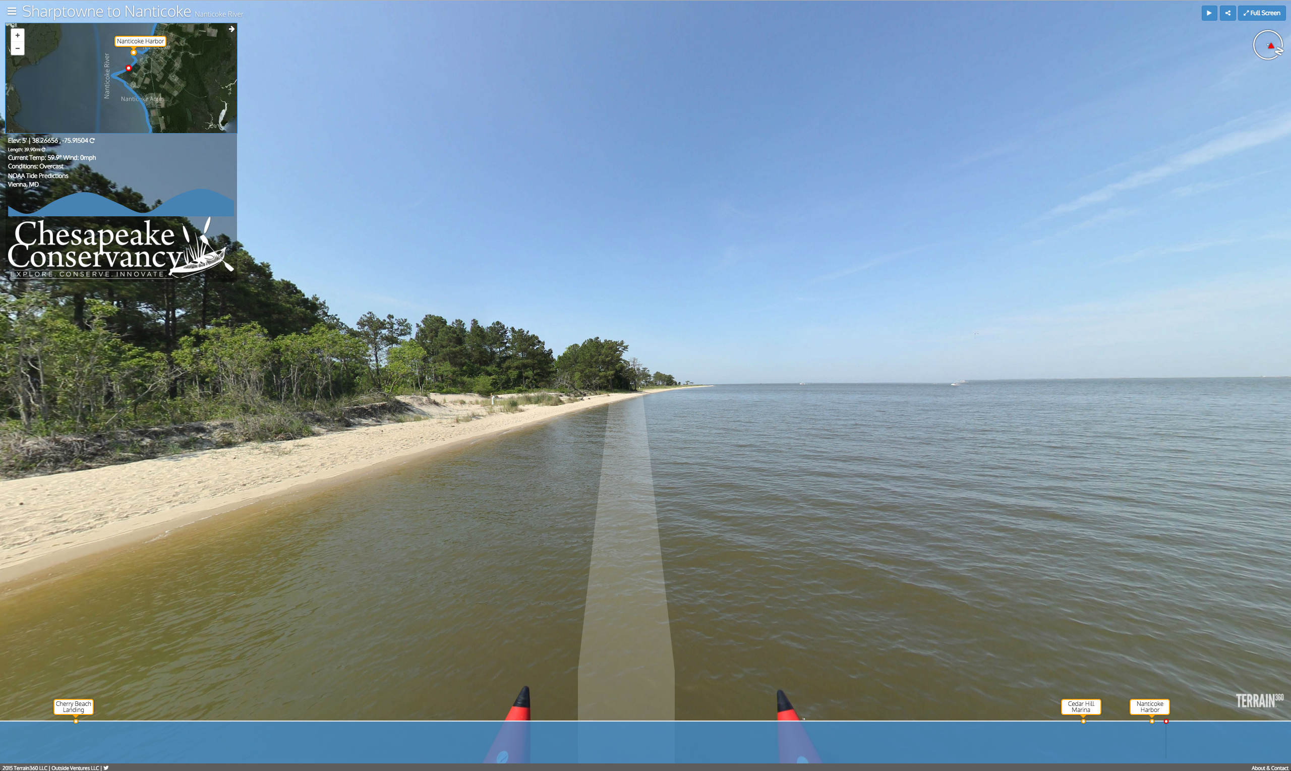
Annapolis, MD – The Chesapeake Conservancy has released a virtual tour of the Nanticoke River, allowing viewers to experience one of the Chesapeake’s most pristine rivers from their computer, smartphone, or tablet. The virtual tour is available at https://www.terrain360.com/map/nanticoke-river and provides an interactive view of the entire river from the perspective of a kayaker. Users can virtually travel down the river with a number of conveniences including geographic locations, and recreational amenities.
 The Nanticoke River flows 64 miles through the states of Delaware and Maryland to Tangier Sound before reaching the Chesapeake Bay. Its 1,133-square-mile watershed is home to hundreds of rare, threatened and endangered species. The Nanticoke provides some of few places to find globally rare plant and animal species, including Harper’s beakrush, Parker’s pipewort, and box huckleberry, as well as unique plant communities such as Atlantic white cedar non-tidal wetlands and xeric sand ridge forests.
“The Nanticoke remains one of the most diverse and intact watersheds in the Chesapeake Bay region. This is one of the few places you can go to see the world as Captain John Smith and the American Indians saw it 400 years ago,” Chesapeake Conservancy President and CEO, Joel Dunn said. “Through this project, the Chesapeake Conservancy is working to connect people and the wildlife and habitats of the Nanticoke. We hope the virtual tour will inspire people to get out and see the beauty of the Nanticoke and the Captain John Smith Trail firsthand and foster a sense of stewardship to ensure the protection of this national treasure.”
“The Conservancy and Terrain360 have made the Nanticoke accessible from the living room or the classroom in an incredibly unique, engaging way,” Delaware Department of Natural Resources and Environmental Control Secretary David Small said. “While there is no substitute for experiencing this great river first hand, the virtual tool is the next best thing for users who want to plan a trip, or just explore all or part of this historical and natural treasure in a matter of minutes.”
“The Maryland Department of Commerce applauds the Chesapeake Conservancy for its efforts to showcase the natural beauty of the Nanticoke River,” Maryland Department of Commerce Secretary R. Michael Gill said. “We hope this new virtual tour will encourage visitors to explore Maryland’s Eastern Shore and enjoy all that it has to offer.”
Earlier this year, the Conservancy and Richmond-based Terrain360 deployed a one-of-a-kind handmade boat, equipped with six cameras mounted 10 feet above the water’s surface to capture high-resolution, 360-degree images every 50 feet. Terrain360 built and operates the pontoon and stitched the images together to create a digital image map of the Nanticoke.
“The virtual tour allows users to plan their trip in advance,” Terrain360’s Andy Thompson said. “The tour will make the Nanticoke River more accessible by limiting the number of unknown factors. People want to know where they can put their kayaks in and where they can take them out. With this tool, they will know what to expect because they have already seen it.”